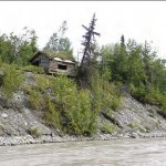
I have been able to watch this river since 1969 when our family moved to Victory High School at mile 95 Glenn Highway. Over that time I have witnessed the Matanuska River do some significant damage to property along it’s edge. I have stopped several times to take photos of the cabin at the top of this page thinking every time that this may be the last time I will see it before it topples into the river. I am amazed that it’s still hanging in there.
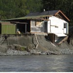
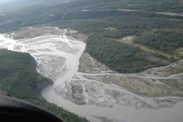
The Matanuska River is a glacial braided stream. This is a type of stream that constantly moves back and forth within a broad stream bed over time. Because it carries so much silt down from the glacier it fills it’s stream bed and then moves over to another channel. If you happen to be living next to that old channel you will eventually see water flowing in your front yard and perhaps even in your living room. Take a good look at the house to the right. Click on the photo to enlarge. You can see the stairway to the basement exposed to the river.
Click here to read the report for yourself.
I’m glad this report is available now for people to study as they make decisions to purchase property along the Matanuska River. When selling property in these areas in the past I have always discussed the dangers of river erosion with my clients. Some people decide not to take the risk while others evaluate the situation and decide that the risk is minimal and they go ahead with their purchase.
One of the places I bring up when talking to buyers is Circle View Subdivision. When my wife and I were looking for our first home we looked at a house on the Matanuska River in this subdivision. As the name implies, the view is incredible. But after growing up on the Yukon River I knew the risks of living near what we called, “a cut bank”. This is a steep bank where the river is actively washing away the soil. I stood at the edge of this bank and watched little bits of gravel slide down into the muddy current of the river. Needless to say, we shied away from that home, and I’m glad we did. That home isn’t there anymore.
The photo below is a good example of the braided Matanuska River.
Photos by Janet Curran and Mary Price courtesy of the US Geological Survey Alaska Science Center


